When
will
storms
hit?
See
hour-by-hour
outlook
as
severe
weather
threatens - Iqraa news

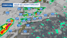
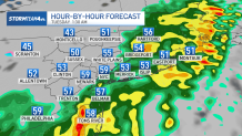
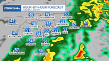
Storms will begin to fire late Monday afternoon in the warm sector ahead of a cold front. Storms will become more intense into the evening and pass west-to-east through the New York metro area.
The brunt of the storms will exit the region by midnight.
On a scale from 1 to 5, the severe threat stands at 2 for much of the tri-state area. That puts us in the "moderate" risk zone.
As for severe weather, damaging straight-line winds will be the biggest threat, followed by hail. Tornadoes can't be ruled out, either, even through the risk is low. New Jersey and parts of New York west of the Hudson River are the areas most likely to see tornadoes form. Here's what to expect this afternoon, hour by hour.
Monday, 5 p.m.

Monday, 6 p.m.

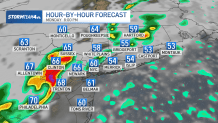
Monday, 7 p.m.
Monday, 8 p.m.
Monday, 9 p.m.
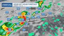
Monday, 10 p.m.

Monday, 11 p.m.

Tuesday, 12 a.m.
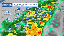
Tuesday, 1:30 a.m.
Tuesday, 2 a.m.


